


Geodetic Antennas vs. Survey-Grade GNSS Antennas: What’s the Right Choice for Precision Mapping?
Why the Right Antenna Matters in Precision Mapping
As demand for accurate positioning data grows across industries like construction, agriculture, and geospatial science, choosing between geodetic antennas and survey-grade GNSS antennas becomes a critical decision. Though both technologies support satellite-based positioning, they differ in precision, durability, and price. This article compares the two to help professionals make an informed choice for precision mapping applications.
Application: Scientific Research vs. Field Surveying
Geodetic antennas are designed for high-precision, long-term applications such as tectonic monitoring, geodetic reference networks, and scientific observation stations. These antennas are often installed in fixed locations to continuously collect positioning data over months or years.
Survey-grade GNSS antennas, on the other hand, are optimized for mobile fieldwork. They are commonly used in land surveying, construction staking, and agricultural mapping where real-time or short-duration data collection is sufficient. While both antenna types support GNSS constellations like GPS, GLONASS, Galileo, and BeiDou, their engineering and use cases differ significantly.
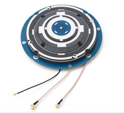
User Group: Research Institutions vs. Field Technicians
Geodetic antennas are typically used by research institutions, national geodetic agencies, and space or geological organizations. These users prioritize millimeter-level accuracy and long-term data stability.
In contrast, survey-grade GNSS antennas cater to civil engineers, land surveyors, and GIS professionals. These users need fast deployment, ease of use, and sub-centimeter accuracy for daily operations—often combining GNSS antennas with RTK or network-based correction services for real-time results.
Performance: Millimeter vs. Sub-Centimeter Accuracy
Geodetic antennas are built with precision in mind. Most feature choke ring designs, low-noise amplifiers, and stable phase center characteristics. For example, the Trimble Zephyr Geodetic Model 3 can maintain phase center variation (PCV) below ±1 mm, which is essential for scientific-grade post-processing.
Survey-grade GNSS antennas, while highly accurate, typically offer phase center variation in the ±2–5 mm range. This is suitable for most commercial mapping tasks. They may lack multipath mitigation features like ground planes or choke rings, but compensate with portability and integration flexibility.
Price: Premium Investment vs. Budget-Conscious Performance
Geodetic GNSS antennas usually come with a higher price tag, ranging from $1,000 to $3,500 depending on design complexity and brand. This reflects their advanced build, environmental resilience, and long-term stability.
Survey-grade GNSS antennas are more accessible, typically priced between $300 and $1,200. This affordability makes them ideal for companies needing multiple units for mobile teams or temporary deployments. However, lower cost often comes with trade-offs in accuracy and signal quality.
Usage Scenario: Fixed Stations vs. Mobile Projects
Imagine a geodetic reference station installed for continental drift monitoring—it must maintain exact positioning for years, withstand environmental stress, and integrate with global networks. A geodetic antenna is the clear choice here.
Now consider a road survey project spanning several weeks. The team needs fast setup, real-time correction, and rugged portability. A survey-grade GNSS antenna fits this task perfectly, offering efficient performance without overinvestment in features that won’t be used.
Advantages and Disadvantages
Geodetic Antennas
Advantages: High precision (millimeter-level), excellent multipath rejection, ideal for long-term monitoring.
Disadvantages: Higher cost, larger physical size, less suited for mobile applications.
Survey-Grade GNSS Antennas
Advantages: Portable, affordable, sufficient accuracy for most commercial uses, compatible with RTK systems.
Disadvantages: Less precision under multipath or interference conditions, limited long-term stability.
Conclusion: Match the Antenna to Your Mission
There is no one-size-fits-all solution in precision mapping. If your project involves long-term, scientific-grade monitoring or contributes to national positioning infrastructure, geodetic antennas offer unmatched stability and accuracy.
However, if your focus is on commercial surveying, mapping, or engineering tasks that demand fast, reliable results on a budget, survey-grade GNSS antennas provide a balanced and effective option. Consider your accuracy requirements, deployment duration, and available budget when making your final choice.